
Essays · Photography
Mark Power. The Shipping Forecast.
A name heard often enough becomes a place, even unvisited.
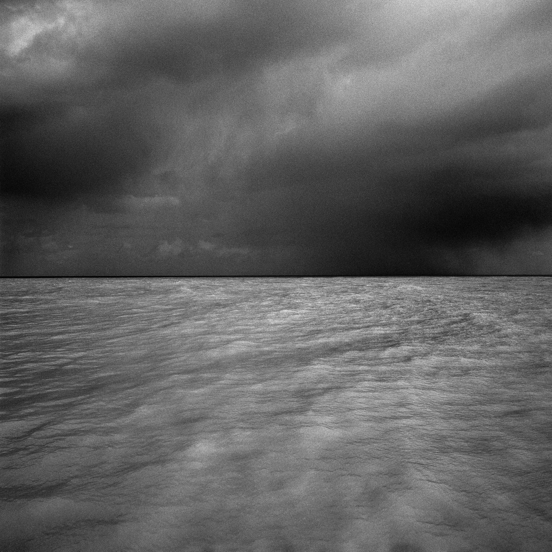
© Mark Power · Magnum Photos
A bulletin read four times a day
The Shipping Forecast is the sea weather bulletin broadcast on BBC Radio 4 four times a day, for ships around the British Isles. The sea is divided into 31 areas, each with a name. The reader moves through them in turn, giving wind direction, strength and visibility in a fixed pattern.
The forecast dates back to the nineteenth century; in 2017 Radio 4 marked its 150th year. Over generations it has become part of British life, far beyond sailors. Many listen without caring how strong the wind is. They listen for the rhythm, the names, the steadiness of it at the end of the day.
The names carry their own charge. Dover, Thames, Humber, Tyne: familiar rivers and harbours. Fair Isle, Hebrides, Malin: the far north. German Bight, South Utsire, Trafalgar: waters off other countries' coasts. Southeast Iceland, far above.
Mark Power, a British photographer, asked a simple question: what do the places behind those names actually look like? Everyone hears the names; very few have stood there.
Four years, 31 names
Power decided to visit all 31 areas. The project took about four years and ended in 1996. He worked in black and white.
At first he paid his own way, after his grant applications were turned down. Three years in, he won the Mosaique prize for European photography in Luxembourg. It let him finish the remaining areas, mount an exhibition with a sound element, and help fund his first book.
The captions are the key. Under each picture Power placed the six o'clock morning forecast from the day it was taken. Area, wind, visibility. Dry, technical language that reads like a familiar liturgy.
And the picture often does not match. There are no huge waves or ships in storms. There are nearly empty beaches, a figure looking out to sea, a corner of a harbour, a resort out of season, human traces at the water's edge.
A landscape of imagination
The Shipping Forecast poses a good question: how do you photograph a place that exists mainly as a name? Many areas are open sea with no shore to stand on. Power had to find the nearest land, an island, or a harbour that carried the spirit of the area.
So the series is not an accurate map. It is a map of feeling. Each picture is one person's answer to a name heard all his life.
It is also about Britain. An island nation seen from its own edge. Small figures before a large sea. Homesickness for a place no one has left. Many viewers recognise in the pictures something they had felt but never seen.
The book, published by Zelda Cheatle Press in 1996, sold quickly and was reprinted twice the following year. Much later the work was reissued and shown again, including an exhibition in Ipswich in 2018.
Why it stays
The Shipping Forecast shows that a body of photographs can begin with sound. Not with a scene once seen, but with a voice once heard.
Beside the horizons of Hiroshi Sugimoto's Seascapes, we see two very different ways of looking at the sea. Sugimoto removes every human trace, keeping only water, sky and the line between. Power does the opposite: he photographs the sea through the people beside it, the harbours, the voice on the radio.
A name can be a place. It only needs to be called often enough, in a calm enough voice.
Photography